There are now 4 that are being watched and the worst one looks like the East Coast, hopefully.
Forecasters on Sunday morning were tracking three disturbances in the Atlantic and one in the Caribbean. It is too early to tell if any will reach the continental U.S. If a system strengthens into at least a tropical storm, the next available storm name is Danielle. Here’s the update from the National Hurricane Center as of 11 a.m. Sunday.
nola.com

via the National Hurricane Center
Central Atlantic
An area of low pressure is over the central tropical Atlantic Ocean and is moving west at around 10 mph, forecasters said. The thunderstorm activity has slightly increased since yesterday, but forecasters said the system lacks organization. Gradual development is expected as it moves toward the waters east of the Leeward Islands. It has a 70% chance of developing into at least a tropical depression within five days.
via the National Hurricane Center
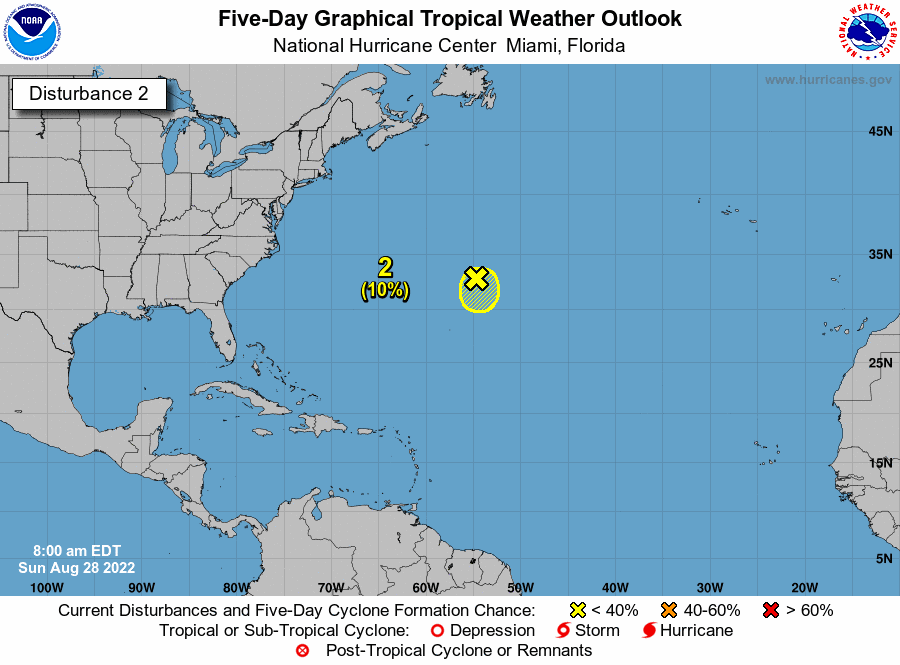
Central Atlantic off the Carolinas
Forecasters are monitoring a small low-pressure system located about 600 miles east of Bermuda. It continues to produce disorganized shower activity. Conditions are expected to limit development as it travels over the central Atlantic over the next few days. It is likely to dissipate by midweek. The chances of it developing over the next five days are low, at 10%.

via the National Hurricane Center
Caribbean and closest to us.
Forecasters are monitoring an area of low pressure in the northwestern Caribbean Sea that could develop by midweek. Conditions are favorable for slow development as it moves northwest toward the Yucatan Peninsula of Mexico. Chances of formation are low at 20%.
via the National Hurricane Center
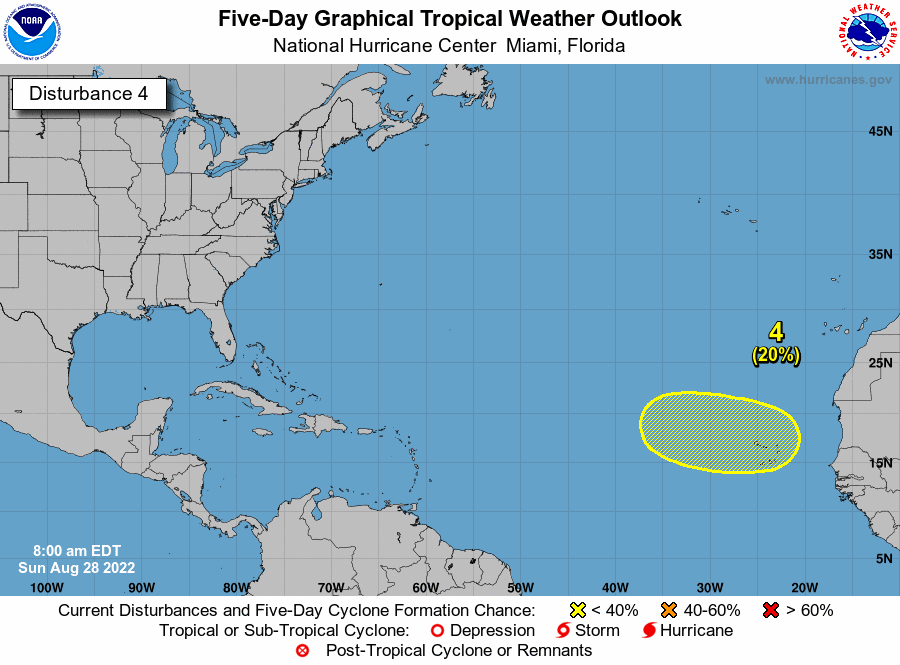
Eastern tropical Atlantic off Africa.
A tropical wave is forecast to move off the west coast of Africa on Monday. Gradual development is possible after that as it moves west across the eastern tropical Atlantic. Chances of formation are low at 20 percent.
I will stop here as the rest of the u[date has been in other posts. Just remember September is the worst month and September 10 is the peak.


