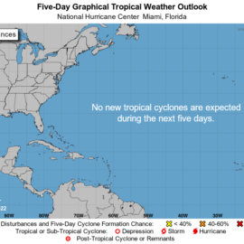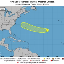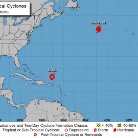
One that may come and another we don’t know about. Off Africa is busy.
A tropical disturbance has entered the Caribbean Sea, but forecasters on Thursday morning said it is too early to say if it will eventually reach the Gulf of Mexico or be a threat to Louisiana. If it were to enter the Gulf, the threat to the Gulf Coast is still more than seven days away, according to Hannah Lisney, a meteorologist at the National Weather Service in Slidell. The system is expected to develop into a tropical depression in a few days, forecasters said, and will most likely be named Hermine if it strengthens into a tropical storm. The disturbance is one of five that forecasters are tracking Thursday morning, including Hurricane Fiona and Tropical Storm Gaston in the Atlantic. Now is the time for residents to review their hurricane plans and make sure their supply kits are prepared for the rest of the season, forecasters said.
nola.com

(satellite image via NOAA)
5 systems in the tropics
Hurricane forecasters are tracking five systems in the Atlantic and Caribbean: Disturbance in Caribbean, Hurricane Fiona, Tropical Storm Gaston, Disturbance off the coast of Africa and Disturbance in the Atlantic. Hurricane Fiona, Tropical Storm Gaston and the disturbance by Africa’s coast don’t pose a threat to Louisiana. It’s too early to accurately say where the Caribbean disturbance could go if it develops. The next storm names are Hermine, Ian and Julia if any of the disturbances strengthen into a tropical storm. Here’s what to know about the tropics as of 7a.m. Thursday from the National Hurricane Center.

Disturbance in the Caribbean
The Caribbean disturbance is currently called Invest 98-L and continues to show signs of organization, according to the 7 a.m. Thursday forecast from the National Hurricane Center. The system was producing showers and thunderstorms over the southeastern Caribbean Sea early Thursday, forecasters said. Environmental conditions are inhibiting development early Thursday, forecasters said, but that’s supposed to change “in a couple of days” and a tropical depression is likely to form then. It has a 70% chance of developing into a tropical depression within 48 hours and a 90% chance of development within five days. The disturbance is expected to move northwest for the next day or two and reach the central Caribbean by the weekend, forecasters said. It will bring heavy rainfall and gusty winds to parts of the Windward Islands, Venezuela and the ABC island chain on Thursday, regardless of development, meteorologists said. It’s too early to tell if the system could reach the Gulf of Mexico and eventually be a threat to Louisiana.

If it were to enter the Gulf, forecasters said Thursday, the immediate threat to the Gulf Coast is still more than seven days away. The shaded area on the National Hurricane Center graphic is where a storm could develop and is not a track. Hurricane forecasters release a track when a tropical depression forms or is about to form. The track shows where the storm could go within five days. The internet has been buzzing this week with the various scenarios for the system, mainly based on long-range computer forecasts.

These models show predictions up to 16 days in advance and change frequently. They are not reliable at forecasting landfall 7 to 10 days in the future. However, they offer scenarios about what could happen. Some of the long-range model runs from the Global Forecast System have shown the system entering the Gulf of Mexico next week. But, it’s too far in the future to predict anything accurately. Forecasts will become more reliable if the disturbance actually forms. Meteorologists with the National Weather Service in Slidell said they understand “the anxiety people are feeling” about the possibility of a storm, but reiterated that it is too early to panic. A good way to handle the anxiety, they said, is to stay informed but try not to focus on possible worst-case scenarios. Also, take action by making a plan and gathering storm supplies ahead of a potential threat, they said. So far, there have been seven named storms this season – Alex, Bonnie, Colin, Danielle, Earl, Fiona and Gaston. The next available name is Hermine. Hurricane season ends Nov. 30, but storms can form any time. The categories, in order of increasing strength, are tropical depression, tropical storm and hurricane (categories 1 through 5). A system is named when it develops into a tropical storm. On the Saffir-Simpson Hurricane Wind Scale, the wind categories are: Tropical depression: up to 38 mph, Tropical storm: 39 to 73 mph, Category 1 hurricane: 74 to 95 mph, Category 2 hurricane: 96 to 110 mph, Category 3 hurricane (major hurricane): 111 to 129 mph, Category 4 hurricane: 130-156 mph and Category 5 hurricane: 157 mph and higher.
So we are in limbo. The Florida statistics imply we are in the three major tracks but, again, we never know until we know.


