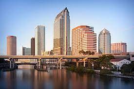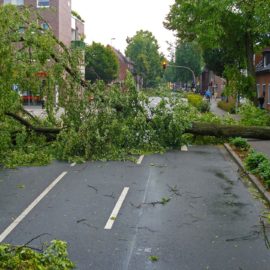
Tampa and New Orleans have many similarities. The main difference is that this is the first time in 100 years a hurricane is coming to Tampa where we see then frequently.
A powerful hurricane pushes toward a vulnerable metropolitan area that sits next to an estuary capable of funneling devastating storm surge onto shore. Epic traffic backs up on highways as residents escape its potential wrath. Sound familiar? That’s not a rehash of Hurricane Katrina, but it certainly could be. It in fact involves the Tampa area on the west coast of Florida as Hurricane Ian barrels toward it, threatening to inundate the densely populated region with a wall of water. The comparison is not exact. The Tampa area is not as low-lying as New Orleans, for one. And the shoddily constructed levees that crumbled during Katrina, which will forever be cursed by New Orleanians, have no analogue in Florida. But there are enough similarities between the two coastlines to bring back extremely bad memories for south Louisianans and provoke comparisons among some meteorologists.
nola.com

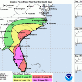
(Satellite image via NOAA)
Both cities have water around them. Tampa the open bay and us the Gulf and Lake Pontchartrain.
The main similarity between the two – and the reason there is such concern over Tampa and St. Petersburg being hit by the storm’s dangerous northeast quadrant, the area most capable of pushing storm surge – involves the contours of the water surrounding them. In New Orleans, it’s Lake Pontchartrain, Lake Catherine, the Rigolets and Lake Borgne eventually leading to the Gulf, not to mention the region’s shipping channels. The Tampa region’s namesake bay creates similar hazards for the area’s roughly 3.2 million residents. The relatively low-lying area, which includes the cities of Tampa, St. Petersburg and Clearwater, has avoided such a major storm for around a century and does not have the kind of levees and gates that aim to protect the New Orleans area. A simulation of a Category 5 storm in the region illustrated the potential damage, showing widespread devastation and catastrophic flooding, according to a Tampa Bay Times report from a couple years ago. The paper said the Tampa Bay area was “considered to be one of the most vulnerable population centers to a hurricane strike.” “I always say whoever decided that it was a brilliant idea to build a city in that area was not thinking straight, or thinking clearly, and I mean that in the most respectful way that I can,” Athena Masson, a meteorologist who teaches at Flagler College in St. Augustine, Florida, said of the Tampa area. “It’s an inlet, and it’s very similar to what happened with Lake Pontchartrain during Hurricane Katrina. Once water gets into that area, it has nowhere else to go. It’s like a bathtub.”
Like with us, small changes in the path can mean a big difference in the damages felt.
The exact path of the hurricane remains unclear though, and forecasts Tuesday put Ian on a track south of Tampa. That could spare the city the worst storm surge, because it would no longer be in the dreaded northeastern quadrant. As of Tuesday afternoon, Ian was a Category 3 storm with maximum sustained winds of around 120 mph, forecast to strengthen and approach Florida’s coast late Wednesday as an “extremely dangerous major hurricane.” That would mean higher storm surge for areas south of Tampa, such as the Charlotte Harbor area, where the National Hurricane Center was warning of elevated water levels of between 8 and 12 feet. LSU coastal meteorologist Paul Miller also spoke of familiar dynamics at work in the New Orleans and Tampa areas, adding that if the storm’s track continues further south, the risk will diminish. “We can end up with water getting funneled between the Mississippi coastline and the east bank of the Mississippi River,” he said of the New Orleans area. If enough unfortunate circumstances line up for Tampa, “it’s kind of an analogous scenario,” he said.
The speed of the storm matters as well. Will it zip through or linger.
Stephen Leatherman, of Florida International University and the former head of the International Hurricane Research Center, noted that another element to watch will be the speed of the storm. He pointed to 2004’s Hurricane Charley, which came ashore along a similar path as a Category 4 storm, but was small in overall size and moved quickly, limiting its surge – and its destruction. He said that the longer the storm sits over an area, “it’s going to give more of a chance to destroy things and also more time to push the water ashore.” Leatherman highlighted one major difference between the Florida and Louisiana coastlines: the prevalence of higher-end development on Florida’s waterfront. “This is a serious, serious storm coming into a very highly populated beach area,” he said. “These are all beaches – highly populated, very expensive real estate, right at the water’s edge, and indeed all the way in for some distance. It’s going to be a hugely damaging hurricane, unfortunately.”
I spent a week in the area and the hotel I was in sat between the bay and the Gulf. The view was amazing but in a hurricane it would not be a good position.


