The study will focus on mud and mud slides as when they occur underwater damage can be made.
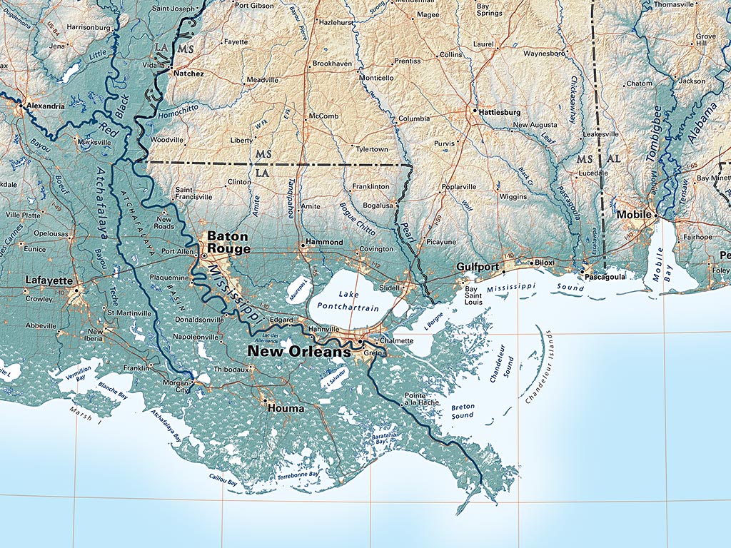
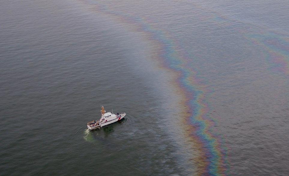
When Hurricane Ivan took aim at the Alabama coast in 2004, the powerful storm triggered an underwater mudslide that collapsed a Taylor Energy oil platform, setting off the longest-running oil spill in U.S. history. Now, a team of LSU researchers is studying how hurricanes and other events lead to mudslides in the Gulf of Mexico, in a bid to better understand the effects of mudslides on offshore energy production of all kinds. To gauge where and when mudslides occur, the LSU team will map the seabed around Louisiana’s “bird’s foot,” or the part of the Mississippi River delta that splits into Southwest Pass, South Pass and Pass a Loutre. Their work amounts to the first comprehensive map of the delta front in more than 40 years, officials said.
nola.com

COAST GUARD ILLUSTRATION
The Bureau of Ocean Management is paying for this survey.
Bankrolling the $3.8 million effort is the federal Bureau of Ocean Energy Management, or BOEM, which issues leases of offshore space for conventional and renewable energy production. Other organizations involved are the Water Institute of the Gulf, the Naval Research Laboratory, or the NRL, and the National Oceanic and Atmospheric Administration, to name a few. “The last major study like this was in the 1970s, and was also led by LSU,” said Sam Bentley, the marine geologist who is leading the team, in a statement. “Much has changed since then, from the seabed conditions to the tools used to map the seabed and the needs for offshore energy infrastructure. The knowledge gaps and possible liabilities are huge.” Bentley added in an interview that BOEM asked his team to begin laying the groundwork for such a study roughly a decade ago. Underwater mudslides occur when loose sediment on an incline starts to slide down the incline all at once due to waves or other shifts. When there are larger waves, like from a storm or hurricane, larger mudslides can form. “Imagine a kitchen board with pancake batter,” Bentley said. “If you want it to flow down slope, down a low angle… you can jiggle [the kitchen board]. When the Mississippi River dumps sediment out of the mouth, mud piles up right offshore. Sometimes, it piles up so steeply that it slides down of its own accord.”
There are 100 oil rigs in the area and all have pipes in the mud.
There are over 100 oil rigs sitting in the bird’s foot, Bentley said, and all of them use pipelines that run through the seabed. When the mud flows down the seabed, even slowly, it can leave oil piping exposed that was meant to be embedded in sediment. And when a mudslide happens, pipelines can be moved miles away from their intended locations. In 2004, a 100-foot-thick slab of mud was the cause of the Taylor energy oil spill. It broke through a pipeline safety valve the oil company relied on to prevent spills. Cleaning up the Taylor Energy spill has cost $353 million so far to plug the leaking wells, with Taylor investing an additional $432.5 million in a trust in case the ongoing clean-up proves more expensive. This doesn’t include another $43 million the company must pay in civil penalties and other federal-led clean-up endeavors. Bentley hopes his team’s research can help energy companies build offshore projects in a safer way. Researchers plan to outfit their equipment with tracking capabilities so that slower, smaller changes in the seabed’s geology will also be shown, changes past surveys of the bird’s foot have missed. “In the past, many surveys were done either before or after landslides, but not during landslides, which often happen when there are hurricanes and river floods,” said Kehui Xu, the LSU Coastal Studies Institute director and a professor in LSU’s Department of Oceanography & Coastal Science. “While regular sensors deployed before such events can be displaced, buried or damaged, we will be working with the NRL to test and deploy some rugged and new sensors that can ‘travel with’ landslides.”
The SS Virginia, sunk by torpedo in WWII will be an anchor for the slide determinations.
Researchers will also rely on a shipwreck to track when and how mud has slid in the bird’s foot over the years. The SS Virginia is an oil tanker from World War II that was sunk by a German U-boat in 1942, an event that killed 27 crew members. The shipwreck is one of the only large landmarks in the bird’s foot that can show the seabed’s history of movement, researchers said. “Shipwrecks, such as the SS Virginia, and what they can tell us about the frequency and trajectory of these mudflow events provide crucial information for BOEM’s decision-making as it relates to oil and gas development on the Mississippi River Delta Front,” said Melanie Damour, a marine archaeologist with BOEM.
The more we know the more we don’t know. This will fill in a hole giving us more knowledge.


