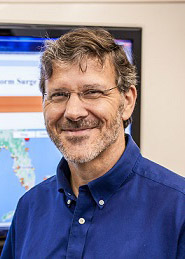
Barry Keim is on the hot seat.
Barry Keim is feeling the heat. Or, more specifically, he closely tracks and analyzes it. As Louisiana’s state climatologist since 2003, he keeps an eye on climate change, hurricane season and the risks associated with them. When it comes to climate change, Louisiana is “the most vulnerable state in the country,” he says. The 58-year-old LSU professor, author and Chalmette native discussed those topics in a conversation with The Times-Picayune | The Advocate. The interview has been edited for length and clarity. All the factors that we look to for a busy season are there. We have warmer-than-normal sea surface temperatures across the breeding grounds. That provides the energy from below to feed into the hurricanes and help produce the hurricanes. And then we also look at what’s going on in the upper air. Is the upper air environment favorable for hurricanes to form? And it just so happens that we’re in a La Nina … So it creates a very favorable upper air environment for hurricanes to form. I think things are going to really start ramping up very soon because we’re marching right now into the teeth of the season. So it’s time to really start watching hurricane season very closely because, historically, between now and about the first week of October, that’s when we’re really in the heart of the season.
nola.com
Why have we had busy seasons recently?
Most years since 1995 have been hyperactive, and that’s all tied in to what the scientists call the Atlantic multi-decadal oscillation. That’s just a fancy-sounding term to index the sea surface temperatures in the North Atlantic. It goes warmer than normal for a few decades, then it goes cooler than normal for several decades. Well, it was cooler than normal from the mid-’60s to the mid-’90s. And since 1995, it’s been warmer than normal. I do want to make note that since about the year 2000, we have had some advances in our technology that enable us to detect more storms than we have ever been able to do before. So what that basically means is that going back historically, we probably missed a lot of these really short-lived storms because we didn’t have the ability to do proper surveillance on those storms. Well, we don’t miss very many of those anymore. And that could at least partly explain why the number of storms has been so high relative to the long-term past.
Can climate change be blamed?
What the general consensus is from the experts is that climate change will probably not change the total number of main storms in a given year. In fact, it will either be about the same amount or it could even be a little bit less. But here’s the kicker: The ones that do form are likely to be stronger.
Then, is it the increased water temperature?
Yeah. Once the ingredients come together to produce a big hurricane, there’s ultimately more energy in the environment to fuel that hurricane. And that gives it the ability to spin up into a larger system.
How is climate change impacting the state?
Louisiana is the most vulnerable state in the country to climate change. That’s an important concept to get across. And the reason is we have so many wetlands and so much land that is close to sea level. And, of course, we’re maintaining parts of New Orleans below sea level. So with climate change, the major thing that threatens Louisiana and what makes us so vulnerable is we have what’s called eustatic sea level rise, which means worldwide sea level rise. That’s like when the Greenland glacier melts and when Antarctica melts and all this water pours into the ocean and all these oceans are interconnected. It raises the global sea level. So the whole world feels that, and Louisiana obviously feels it because we have a lot of land right near sea level. So it doesn’t take a lot of rise to make a lot of land disappear, more so than other places. And then to compound that here in Louisiana, we’re sinking. You throw in all the other compounding factors, like nutria eating our marsh and the canals that are cut for navigational purposes and oil exploration, and we’ve weakened the fabric of our wetlands. They’re sinking on top of it and disappearing. That makes cities like New Orleans, Baton Rouge, Lafayette — all these cities along the I-10 corridor — that much more vulnerable to hurricanes when they do come in because we no longer have that buffer of those wetlands.
So we are in bad shape?
Exactly — there you go.
Interesting discussion and one that shows little hope for the long term.
