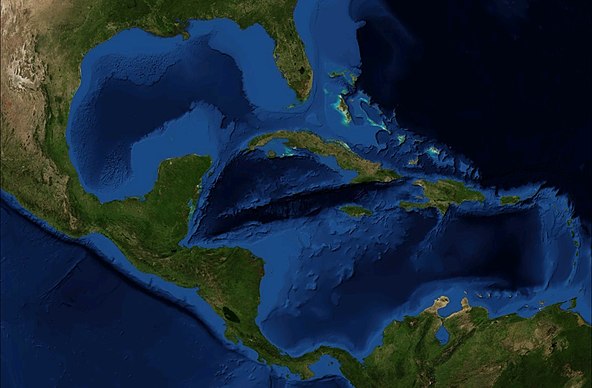
Agatha is still in the Pacific and crossing Mexico. Some form of remnants will come into the Gulf.
Hurricane Agatha set a record after forming in the Pacific, but its remnants pose no risk so far to Louisiana despite a high chance of a tropical depression forming in or near the Gulf of Mexico in the days ahead, forecasts showed Tuesday. While Louisiana remains out of the potential path for now, Agatha’s remnants highlight the risks of the 2022 hurricane season, which begins Wednesday and ends November 30. Agatha hit Mexico’s Oaxaca state as a Category 2 storm Monday, setting the record for strongest hurricane to make landfall in May in the eastern Pacific season. It has now been downgraded to a tropical storm, but its remnants are expected to continue moving through Mexico, according to the National Hurricane Center.
nola.com
It is in Southern Mexico and drenching the land underneath as it moves East.
As the system continues moving, parts of Mexico, Belize and Guatemala can expect locally heavy rainfall over the next couple of days. Power had been restored to some communities near the coast, but some bridges had reportedly been washed out and mudslides blocked a number of the state’s highways. San Isidro del Palmar, only a couple miles inland from the coast, was swamped by the Tonameca river that flows through town. Residents waded through neck-deep water to salvage what items they could from their homes, walking gingerly with piles of clothing atop their heads and religious figures in their arms.
We can expect a tropical depression or maybe tropical storm.
In its 1 p.m. update Tuesday, the NHC said there is a low, or 30 percent, chance for a tropical depression to form between the Gulf of Mexico and the Caribbean Sea within the next 48 hours. Over the next five days, there’s a 70 percent chance of formation. “This system is likely to become a tropical depression while it moves northeastward over the northwestern Caribbean Sea and southeastern Gulf of Mexico late Thursday or Friday,” NHC meteorologist Andrew Levine wrote Tuesday. If the remnants of Hurricane Agatha are the catalyst for a named storm, such a storm would be given a new name from the 2022 Atlantic hurricane name list. Atlantic-Pacific crossover hurricanes are rare, though the remnants of a dissipating storm giving rise to a new hurricane is more common. The first name on the Atlantic hurricane season list is Alex. According to The Weather Channel, in 2020 Tropical Storm Amanda formed in the Pacific and dissipated in Guatemala, subsequently giving rise to Tropical Storm Cristobal in the Bay of Campeche. The last hurricane to do so was Hurricane Otto, which formed in the Caribbean Sea in 2016 and dissipated over the Eastern Pacific Ocean.
We are being advised to prepare.
State officials have been urging Louisianans to prepare for this year’s hurricane season, with forecasters predicting another above-average year. The season arrives with parts of south Louisiana still recovering from the last couple years, which saw two of the most powerful storms in state history in Hurricanes Laura and Ida. Laura tore apart much of southwest Louisiana in 2020, while Ida did the same in the state’s southeast last year. More than 9,000 households are living in post-storm trailers provided by FEMA and the state. NOAA has forecasted 14-21 named storms this season, including three to six major hurricanes, or those Category 3 and above. If those predictions prove correct, it would be the seventh straight above-average hurricane season.
It is the season to watch south of us with more care.
