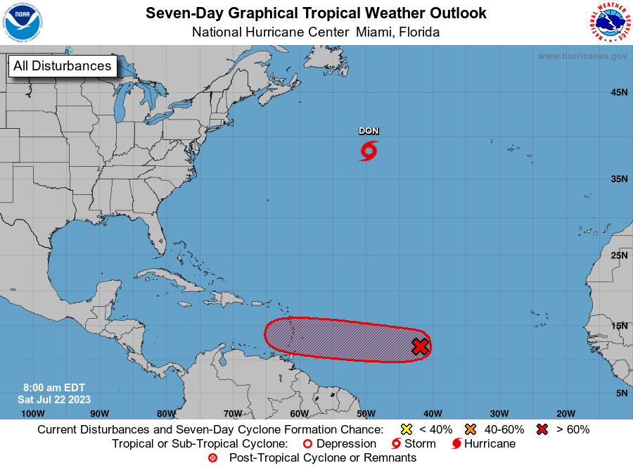
Don continues heading north in the middle of the Atlantic but the one off Africa is now almost at South America.
Tropical Weather Outlook
NWS National Hurricane Center Miami FL
800 AM EDT Sat Jul 22 2023

For the North Atlantic...Caribbean Sea and the Gulf of Mexico:

Active Systems:
The National Hurricane Center is issuing advisories on Tropical
Storm Don, located over the central Atlantic.

1. Central Tropical Atlantic (AL95):
Shower activity associated with a small area of low pressure located
roughly midway between the Cabo Verde Islands and the Lesser
Antilles continues to show signs of organization. Although
environmental conditions are only marginally conducive, some
additional gradual development is anticipated and this system will
likely become a tropical depression by early next week while it
moves westward across the tropical Atlantic.  Interests in the
Lesser Antilles should monitor the progress of this system.
* Formation chance through 48 hours...medium...50 percent.
* Formation chance through 7 days...high...70 percent.
nhc.noaa.gov
In all likely hood we will have a TD in the Gulf.
A disturbance in the Atlantic has a medium chance of becoming a tropical depression by early next week, the National Hurricane Center says. Forecasters said on Friday afternoon that the area of low pressure located roughly halfway between West Africa and South America is still disorganized, but conditions over the next few days are favorable for development into a tropical system. “Although there is dry air located to the north of the system, favorable upper-level winds are expected to allow for gradual development during the next several days,” said NHC forecasters. The area shaded in the graphic above is not a track, but an expected area for the disturbance to develop. Tracks are reserved for tropical storms and hurricanes. The system is expected to move westward, with a 60% chance for it to become a tropical depression in the next week.
nola.com
No, the cone is not a track but it is!


