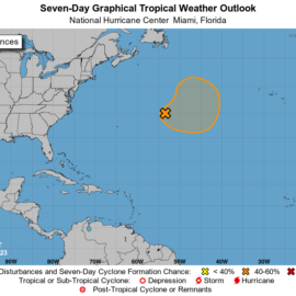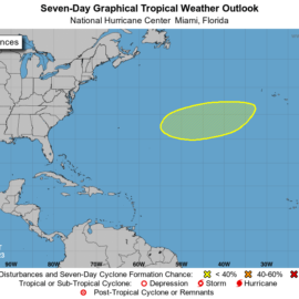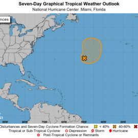
Back to two as one sprung up off South Carolina.
Tropical Weather Outlook
NWS National Hurricane Center Miami FL
800 AM EDT Sun Jul 30 2023

For the North Atlantic...Caribbean Sea and the Gulf of Mexico:

1. Central Tropical Atlantic (AL96):
Disorganized showers and thunderstorms continue in association with
a broad area of low pressure located a little less than 1000 miles
east-northeast of the Leeward Islands. Environmental conditions are
forecast to be marginally favorable for gradual development of this
system during the next few days, and a tropical depression is likely
to form during the early part of this week. The system is expected
to move northwestward at about 15 mph during the next day or so, and
then turn northward over the central subtropical Atlantic by late
Monday or Tuesday.
* Formation chance through 48 hours...medium...40 percent.
* Formation chance through 7 days...high...70 percent.

2. Off the Carolina Coast:
Shower and thunderstorm activity has increased in association with a
trough of low pressure that recently emerged off the Carolina
coastline, and is currently located about 100 miles south of
Wilmington, North Carolina. Environmental conditions appear
generally favorable for some additional development over the next
day or two as the system gradually accelerates east-northeastward
into the northwestern Atlantic ocean. Afterwards, this system is
likely to merge with a frontal boundary.
* Formation chance through 48 hours...low...20 percent.
* Formation chance through 7 days...low...20 percent.
nhc.noaa.gov
The Gulf stays calm.
Hurricane forecasters are watching a mid-Atlantic Ocean tropical wave that they give a 70% chance of developing into a depression within the week. They predicted Saturday it will curve north, well away from the Gulf of Mexico. At 8 a.m., (Saturday) the storm system was about 1,100 miles east of the Leeward Islands and moving west at about 15 mph. The National Hurricane Center said a tropical depression is “likely to form” early next week. The 2023 return of El Niño, a set of Pacific Ocean conditions that affects weather worldwide, could bring more rain to Louisiana for the rest of this year but also a lower risk of hurricanes. Regardless, forecasters see an above-averge 18 names storms in the 2023 Atlantic basin hurricane season. Emily and Franklin are the next names available.
nola.com
We got some rain yesterday which the grass needed. This is my next to last day of posts.


