Hurricane Fiona turned even before Cuba and is heading to Bermuda. Puerto Rico did not fare to well.
Hurricane Fiona was bearing down on the Dominican Republic early Monday after knocking out the power grid and unleashing floods and landslides in Puerto Rico, where the governor said the damage was “catastrophic.” No deaths have been reported, but authorities in the U.S. territory said it was too early to estimate the damage. More rain is expected, with up to 30 inches of rain possible in parts of Puerto Rico. Fiona previously battered the eastern Caribbean, killing a man in the French territory of Guadeloupe when floods washed his home away, officials said. The storm has turned north and is heading back into the Atlantic, where it is expected to strengthen into a Category 3 hurricane. Hurricane forecasters also are tracking another disturbance in the Atlantic, but it doesn’t pose an immediate threat to land. Meanwhile, the Gulf of Mexico is expected to be quiet for the next 48 hours. Here’s what we know about the tropics as of 7 a.m. Monday from the National Hurricane Center.
nola.com
Catastrophic flooding is what they said hit Puerto Rico and with more rain expected it will get worse.
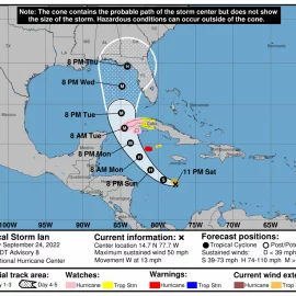
Hurricane Fiona was about 35 miles southeast of Samana, Dominican Republic, as of 7 a.m. Monday and was heading northwest at 8 mph. It is expected to move over the eastern portion of the Dominican Republic during the next few hours and emerge over the Atlantic later Monday. It’s then expected to pass near or east of the Turks and Caicos on Tuesday. It has winds of 90 mph, which means it is a strong Category 1 hurricane. Category 2 storms have winds of at least 96 mph. It’s expected to strengthen into a Category 3 storm by Wednesday, with peak winds of 125 mph. President Joe Biden has declared a state of emergency in Puerto Rico, where the storm disrupted transmission lines on Sunday, leading to “a blackout on all the island,” according to the main utility company. The storm pummeled cities and towns along Puerto Rico’s southern coast that have not yet fully recovered from a string of strong earthquakes starting in late 2019.

Disturbance in the Atlantic
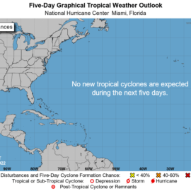
Hurricane forecasters also are tracking a poorly defined disturbance that’s over the central Atlantic. It’s moving north over the open water, and forecasters said some slow development is possible during the next couple days. It has a 20% chance of developing into at least a tropical depression within 5 days. The shaded area on the graphic is where a storm could develop and is not a track. The National Hurricane Center releases a track when a tropical depression forms or is about to form. The categories, in order of increasing strength, are tropical depression, tropical storm and hurricane (categories 1 through 5). Systems are named when they develop into a tropical storm. The next available name is Gaston.
This was the one with the most chance of coming near us and so now back to watching Africa to see what they will produce. I read today that there is dry air over Africa which is working to our advantage.


