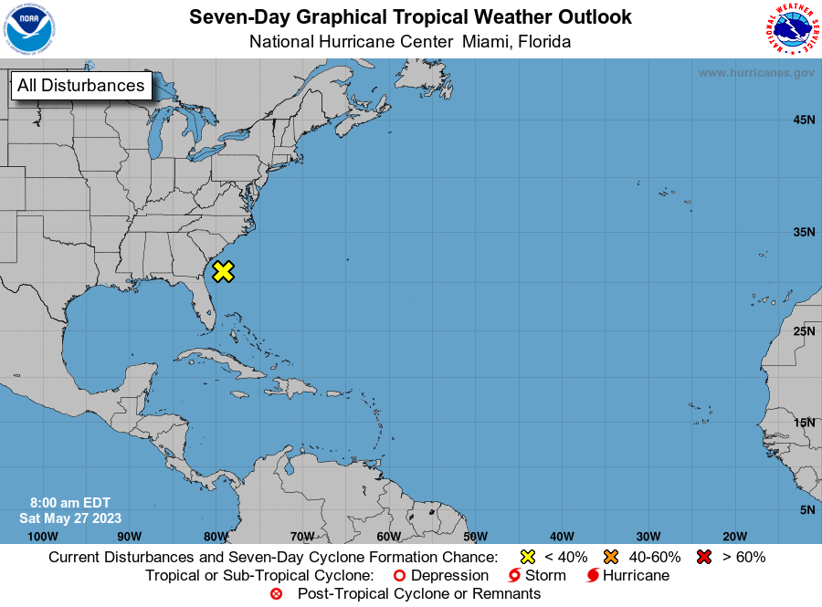
Still just the disturbance we saw which is not moving much nor developing into a threat.
A non-tropical low pressure system located about 150 miles south
of Charleston, South Carolina, continues to produce gusty
winds and disorganized showers and thunderstorms over portions of
the southeastern United States and western Atlantic Ocean. This low
is expected to remain a frontal system while it moves northward and
inland over the Carolinas tonight or early Sunday.  Even though
development into a subtropical or tropical cyclone is
not expected, the system will produce gusty winds and dangerous
surf and rip current conditions along portions of the southeastern
United States coast through Sunday. Heavy rainfall is expected in
portions of the Carolinas and Virginia during the next couple of
days. Hazardous marine conditions are also expected over the
coastal and offshore waters where gale and storm warnings are in
effect. For more information, see products from your local National
Weather Service office and high seas forecasts issued by the
National Weather Service.
* Formation chance through 48 hours...low...near 0 percent.
* Formation chance through 7 days...low...near 0 percent.
For us, a quiet holiday!
Hurricane Season 2023 for 27 May 2023


