(Image via National Hurricane Center)
Still only two to watch but one is approaching the Caribbean.
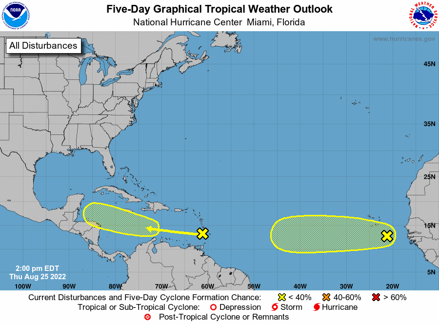
Hurricane forecasters on Thursday morning were tracking two disturbances in the Atlantic, with one expected to move into the Caribbean. It is too early to tell if they could eventually reach the continental U.S. The next available name is Danielle if either strengthens into at least a tropical storm. Meanwhile, the Gulf of Mexico is expected to be quiet for the next 48 hours, forecasters said. Here’s what we know about the tropics as of 1 p.m. Thursday from the National Hurricane Center.
nola.com

Disturbance heading to the Caribbean.
A trough of low pressure was the Windward Islands as of Thursday afternoon, forecasters said. It is expected to move west at 15 mph across the Caribbean during the next several days. The system is currently disorganized, forecasters said, but environmental conditions could become more conducive for slow development early next week when it moves across the Caribbean. It has a 20% chance of developing into at least a tropical depression within five days. The shaded area on the graphic is where a storm could develop and is not a track. The National Hurricane Center releases a track when a tropical depression forms or is about to form. The categories, in order of increasing strength, are tropical depression, tropical storm and hurricane (categories 1 through 5). Systems are named when they develop into a tropical storm.
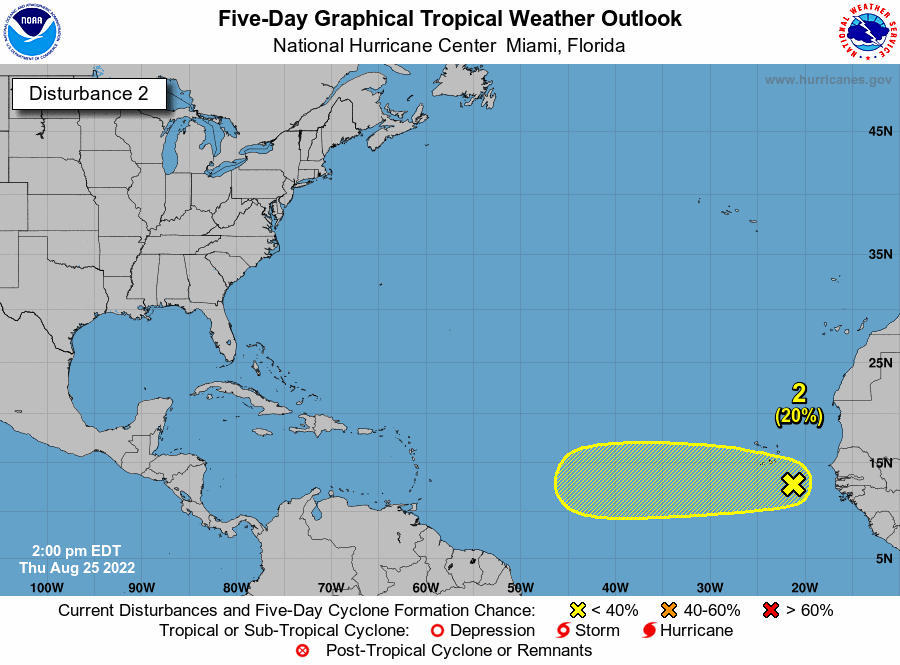
Tropical wave in the Atlantic.
A tropical wave is between the west coast of Africa and the Cabo Verde Islands and is moving west at 15 to 20 mph, forecasters said. It has a large area of disorganized showers and thunderstorms. Some slow development of this system is possible through early next week, forecasters said. It has a 20% chance of developing into at least a tropical depression within five days.
Historically this is the busiest time of the season, The prior post gives some ideas on why it is not, so far.
This is historically the busiest time of the Atlantic hurricane season. In the last 100 years, the tropics have been the most active in August, September and October, with Sept. 10 being the peak of the season, according to federal forecasters. About 80% of the systems that have hit the Gulf Coast formed during this time, according to the National Weather Service in Slidell. So far, there have been three named storms this season – Alex, Bonnie and Colin. Hurricane season ends Nov. 30, but storms can form any time.
I will stop here as the remainder is in the first post on what to do as we wait.


