(Image via National Hurricane Center)
Still 4 out there but the red one looks safe for us, but not the East Coast.
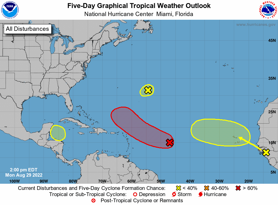
A tropical depression is likely to form in the Atlantic Ocean later this week, hurricane forecasters said Monday afternoon. It’s one of four disturbances they are tracking in the Caribbean and Atlantic. The active tropical outlook comes on the anniversaries of Hurricane Katrina and Hurricane Ida. It’s also the busiest time of the Atlantic hurricane season in terms of storm development. It is too early to tell if any of the current disturbances could eventually reach the continental U.S. The next available storm name is Danielle. The shaded area on the graphic is where a storm could develop and is not a track. The National Hurricane Center releases a track when a tropical depression forms or is about to form. The tracks show where the storm could go within five days. Here’s what to know about the tropics as of 1 p.m. Monday from the National Hurricane Center.
nola.com
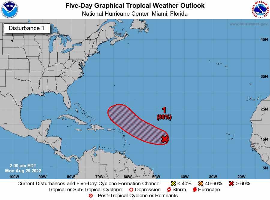
Depression in the Atlantic
A tropical depression is likely to form later this week in the Atlantic, forecasters said. It’s expected to move slowly west and then northwest at 5 to 10 mph toward the waters north of the Leeward Islands. As of 1 p.m., the low pressure system was over the central Atlantic and was producing a large area of disorganized cloudiness and showers. Some gradual development is expected over the next several days. It has an 80% chance of developing into at least a tropical depression within five days.
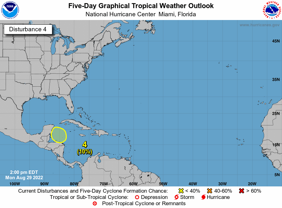
The Caribbean
A trough of low pressure could develop over the northwestern Caribbean Sea later this week, forecasters said. Environmental conditions could support some slow development while it moves northwest over the Caribbean toward the Yucatan. Forecasters have decreased the development chances for the system, saying it only has a 10% chance of developing into at least a tropical depression within five days.

Near Bermuda
A small low pressure system is about 600 miles east of Bermuda. It’s producing limited shower activity, forecasters said, and environmental conditions are expected to limit significant development. It’s expected to drift south to southwest over the central Atlantic during the next couple days, forecasters said, and will likely dissipate by the end of the week. It has a 10% chance of developing into at least a tropical depression within five days.

Off Africa
A tropical wave is expected to move off the west coast of Africa late Monday or early Tuesday, forecasters said. Some gradual development of this system is possible while it moves generally west across the Atlantic. It has a 30% chance of developing into at least a tropical depression within five days.
I will stop here as the rest of the article is boilerplate that is on all of these. One close and the one off Africa may come near us.


