(Image via National Hurricane Center)
Sadly I may have made the right prediction.
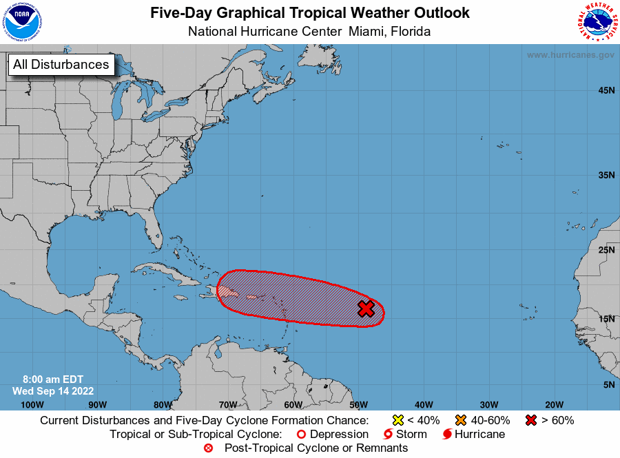
Hurricane forecasters on Wednesday were tracking a disturbance in the Atlantic that could develop into a tropical depression and make its way toward the Virgin Islands and Puerto Rico. The system became better organized overnight and “only a slight increase in organization” would lead to the formation of a tropical depression, forecasters said in their 7 a.m. outlook. It has a 70% chance of developing into a tropical depression within 48 hours, according to the National Hurricane Center. The next available name is Fiona, if it strengthens into a tropical storm.
nola.com
Where is it going?
As of 7 a.m., the system was about 800 miles east of the Lesser Antilles. It is heading west, but it is too early to accurately say where it could go if it develops. Forecasters advised residents in the Leeward Islands, the Virgin Islands and Puerto Rico to monitor this system. The shaded area on the graphic is where a storm could develop and is not a track. The National Hurricane Center releases a track when a tropical depression forms or is about to form. The categories, in order of increasing strength, are tropical depression, tropical storm and hurricane (categories 1 through 5). Regardless of development, the system is expected to be gusty winds and heavy rainfall to parts of the Leeward Islands on Friday and Saturday. The Gulf of Mexico is expected to stay quiet for the next 48 hours, forecasters said.
They will be wacthing this one with care as if it goes to Puerto Rico the Caribbean is there.


