There are a number of projects rebuilding land.
Keeping two New Orleans lakes separated. Filling in the “Golden Triangle.” And the biggest marsh restoration project ever attempted by the state. Those are among the projects under construction and on track to build nearly 11 square miles of new land by early 2023, state officials say. While only a tiny portion of the amount of land lost over the last century, it still amounts to more than 5,300 football fields’ worth of wetlands that will help buffer Louisiana from storm surge. The projects are located in Orleans, Jefferson, Plaquemines and St. Bernard parishes, using sediment dredged from area lakes and bays and the Mississippi River. Barry Richard, senior engineer with the state Coastal Protection and Restoration Authority, gave an update at a recent meeting of the agency’s board on six major projects expected to cost about $527 million. They are separate from the state’s unprecedented $2 billion plan to divert sediment from the Mississippi River into Barataria Basin as a more permanent solution to land loss in that area. That project, called the Mid-Barataria Sediment Diversion, is expected to create and maintain about 20 square miles of new wetlands over a half-century, though it has drawn strong opposition from commercial fishermen in the area. CPRA chairman Chip Kline says the state’s success in rebuilding wetlands is getting lost in the debate over the diversion, which could see construction as early as next year. If that project and the similar Mid-Breton Sediment Diversion on the river’s east bank are built, they will help extend the life of the new work spotlighted in Richard’s update, state officials say.
nola.com

New Orleans Landbridge project
The $23.5 million New Orleans Landbridge Shoreline Protection and Marsh Creation project is restoring 284 acres of brackish marsh along U.S. 90 on the eastern shore of Lake Pontchartrain in the Lake St. Catherine area. The project is designed to keep the landbridge separating Lakes Pontchartrain and Borgne intact. That strip of land reduces the amount of hurricane storm surge entering Lake Pontchartrain and threating both New Orleans lakefront levees on the south shore and northshore communities, including Slidell, Mandeville and Covington. Containment berms for two of three cells that will be filled with sediment to create a platform for marsh grasses have been completed. The project includes construction of articulated concrete mats being placed along the landbridge’s Lake Borgne shoreline to reduce erosion caused by wave energy. The project is funded by the federal Coastal Wetlands, Planning and Protection Act, with Louisiana paying about 15%.

(Coastal Protection and Restoration Authority)
Golden Triangle Marsh Creation
A $54.7 million plan to rebuild wetlands in the Golden Triangle area near the Lake Borgne surge barrier in that lake’s northwestern corner is one of several projects that have been delayed by a scarcity of dredges. This project will eventually include restoration of 700 acres — just over a square mile — lost over the years in connection with the now-closed Mississippi River-Gulf Outlet shipping channel. State officials are working with the dredge contractor to have it returned to the Golden Triangle as the other project is completed, Richard said. The project is being paid for with money resulting from the BP Deepwater Horizon oil spill in 2010.

Lake Borgne Marsh Creation
The Lake Borgne Marsh Creation project will restore 2,769 acres — over 4.3 square miles — along the lake’s south shore from Shell Beach to near Lena Lagoon, with $114.6 million from BP oil spill funds. It’s the largest single project attempted by CPRA, Richard said. The contractor actually got a head start on construction in advance of its official start time, but the dredge was reassigned by the Army Corps of Engineers to maintenance dredging in Barataria Pass. Richard said construction is expected to resume in November. It is part of a larger strategy aimed at rebuilding the lake’s rim and marsh habitat in the area, with emphasis on protecting local communities. One unusual feature includes the creation of two circular areas of open water amidst new marsh as shelter for migrating waterfowl. It’s also being paid for with BP spill money.
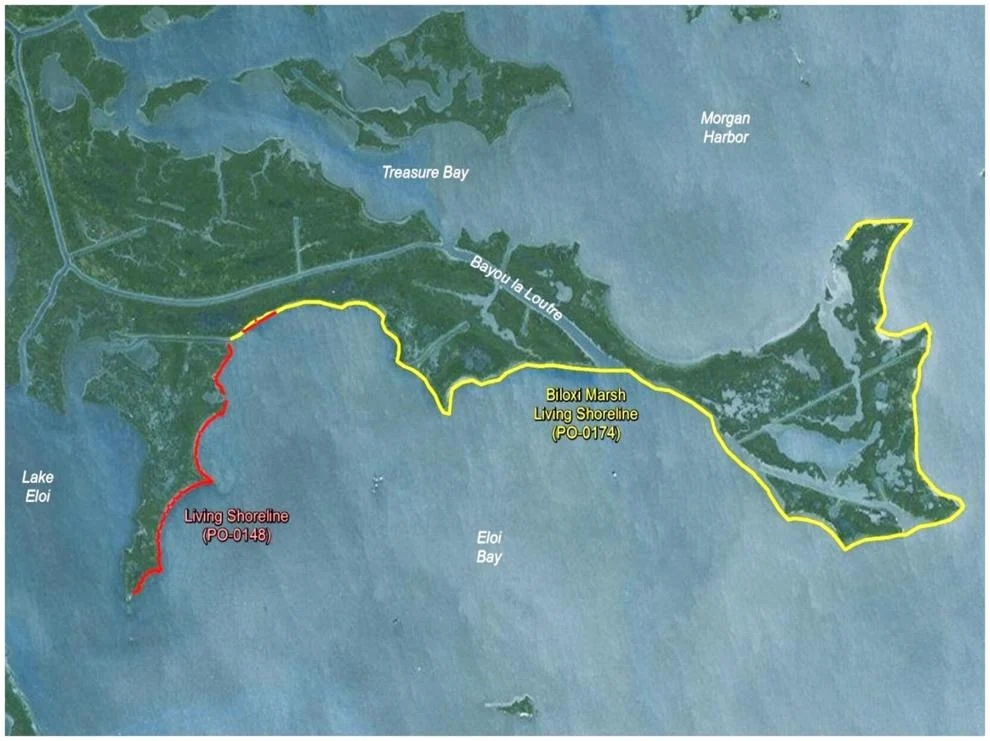
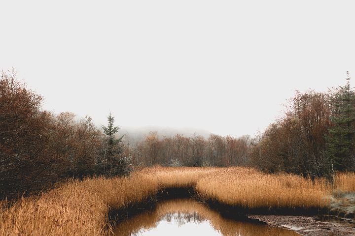
Biloxi Marsh Living Shoreline
The Biloxi Marsh Living Shoreline project is designed to reduce the loss of fragile wetlands along the southeastern segment of Bayou La Loutre, through the use of two types of artificial reef breakwater structures. One is a concrete pyramid designed for water to flow through, called Wave Attenuation Devices, or WADS. The other is a combination of interlocking concrete structures designed to look like children’s jacks, called ShoreJax. Both are being placed along 11 miles of the wetland edge, where they are expected to be colonized by oysters, in hopes they speed the creation of new oyster reefs. Tests by the state in 2017 indicated that they begin seeing oysters attaching to their concrete sides within 3 1/2 years. This $66.6 million project also is being paid for with BP spill funds.

Artificial reef breakwater structures

Spanish Pass Marsh and Ridge
Construction of the Spanish Pass Marsh and Ridge project, on the west bank of Plaquemines Parish near Venice, is more than 70% complete, but work has been paused so its dredge can be used by the Corps for river maintenance. The dredge will return in March to finish the project, Richard said. Under construction since early 2021, it will include 1,538 acres of new marsh and 130 acres of ridge. The project’s $91.5 million cost is coming from BP spill funds.

Upper Barataria Marsh Creation
The state’s new Upper Barataria marsh creation project, also designed to create 1,538 acres just north of the proposed location of the Mid-Barataria Sediment Diversion, is the latest expansion of a plan to rebuild a landbridge stretching across parts of Plaquemines and Jefferson parishes. In 2009, the state began the first of five restorations dubbed the Bayou Dupont project, the first time the state dredged sediment from the Mississippi and pumped it inland through what would become a six-mile-long pipeline to create new land. The new project will use 8.4 million cubic yards of sediment pumped through portions of that pipeline, and will cost $176 million, paid for with BP spill funds. Containment dikes for three new marsh cells were completed in early 2022, but the dredge was reassigned by the corps to build an underwater levee near Myrtle Grove to block saltwater from the Gulf of Mexico from reaching public water supplies, a consequence of the current extremely low river levels. That short-term project was completed last week and the dredge was returned to the Upper Barataria project on Friday, said a spokeswoman for NOAA, which is overseeing the restoration project.
Many projects and creating land. What we need!


